
 CZ
Photogrammetry · new
Drone 3D model and orthophoto
3D models of buildings and their surroundings, orthophoto maps and point clouds. Input data for visualization studios, architects and developers in Brno and South Moravia.
- Options
- data capture to your spec, or full processing
- Detail
- 1–4 cm per pixel depending on altitude
- Scale
- deviation in tests 0.2–0.3 %
- Price
- custom quote by area and deliverables
Photogrammetry turns dozens to hundreds of overlapping aerial images into a 3D model and an orthophoto. The result faithfully matches the shape, proportions and scale of the object. It is not a land survey: the drone has no RTK, so outputs are not meant for cadastral or permit purposes.
Drone 3D model of a family house
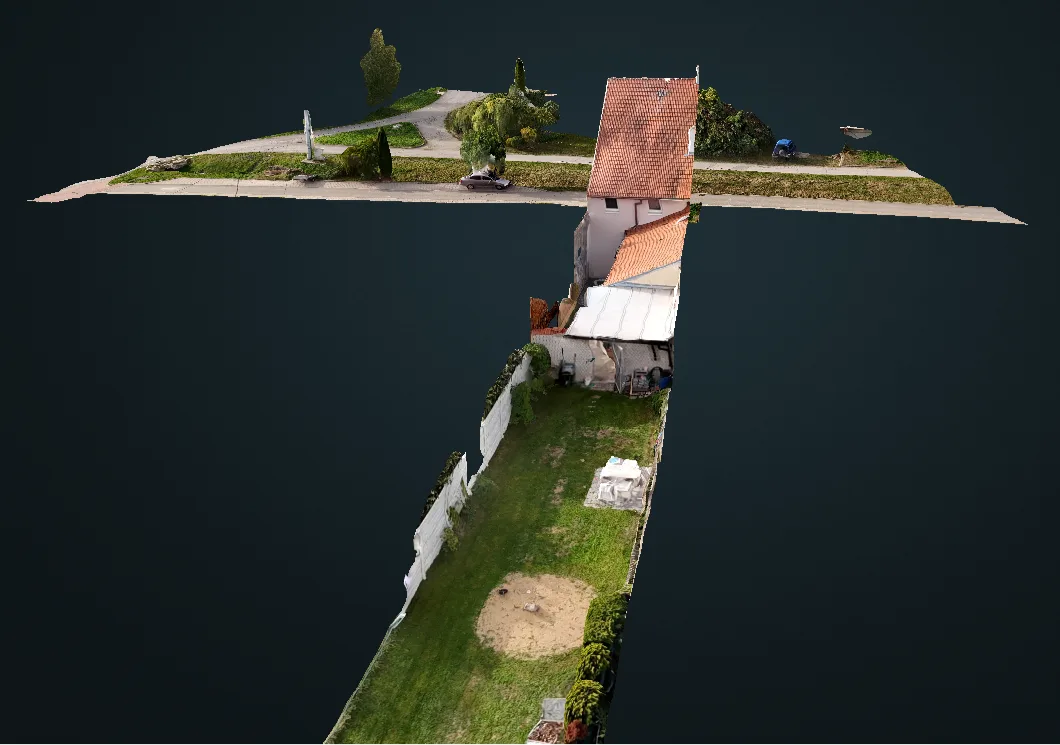
Textured 3D model of a house, courtyard and garden from 173 images, 1 cm/px. The model can be rotated and measured; surroundings are clipped.
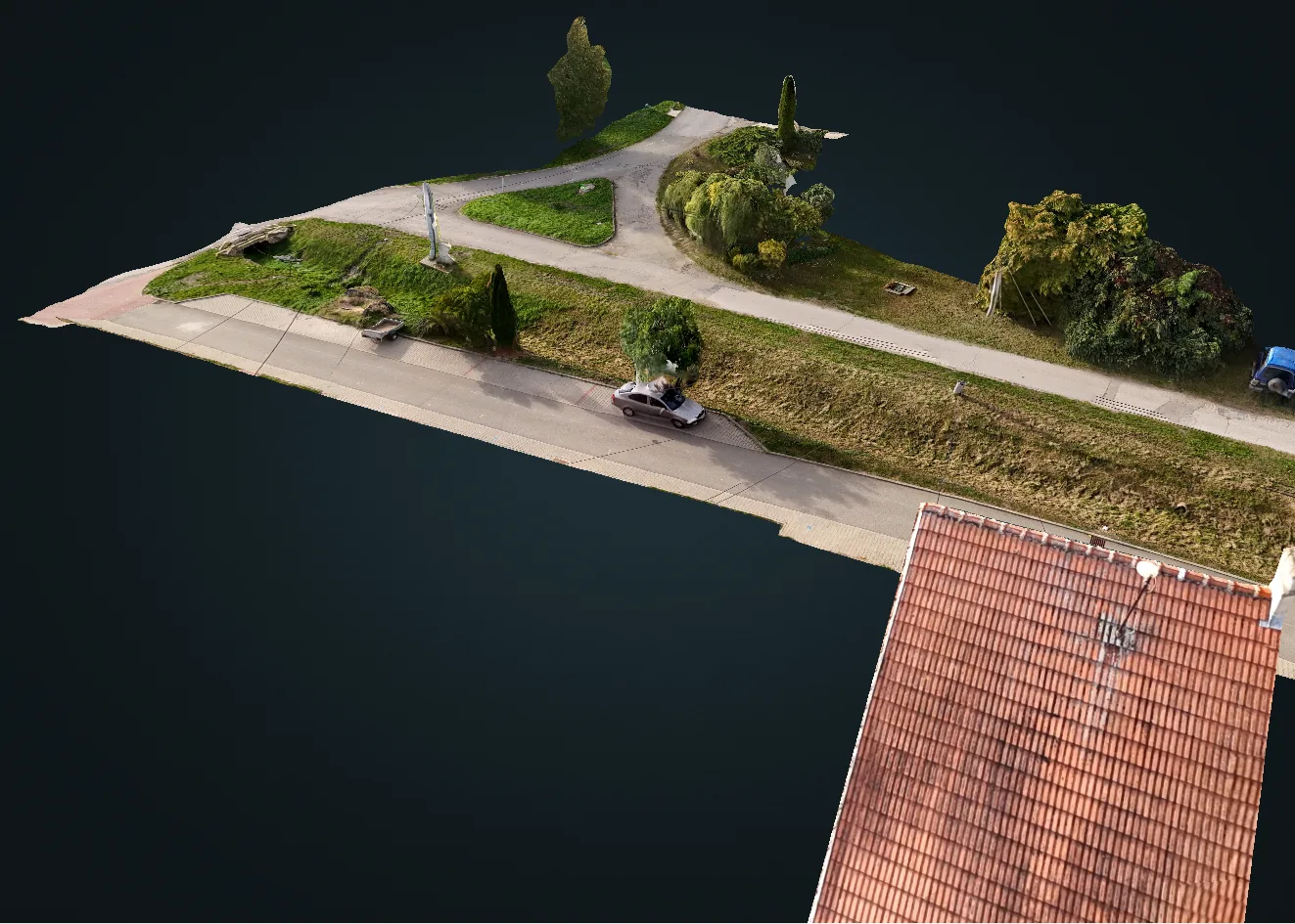
Model detail: roof tiles, street and greenery in full 3D.
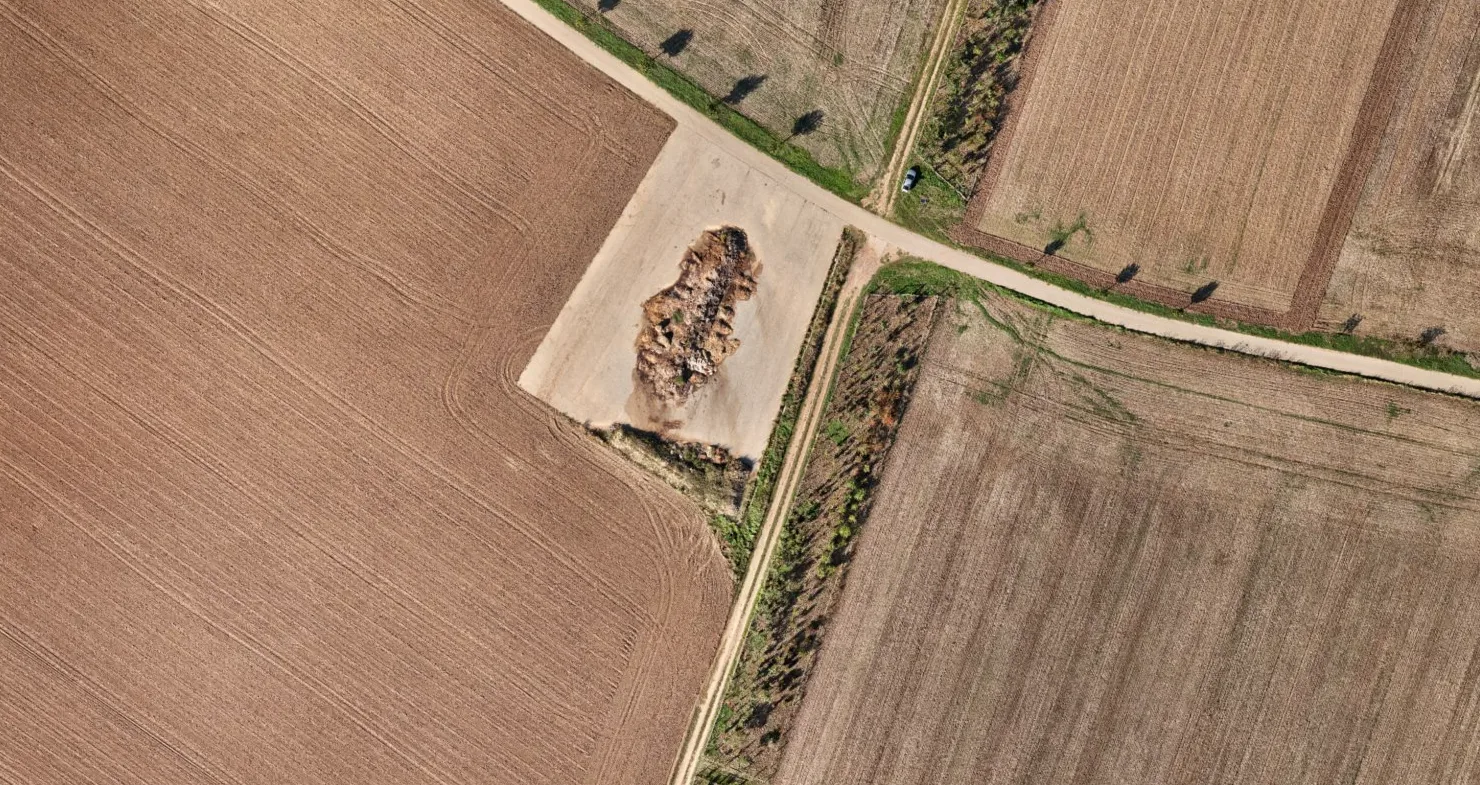
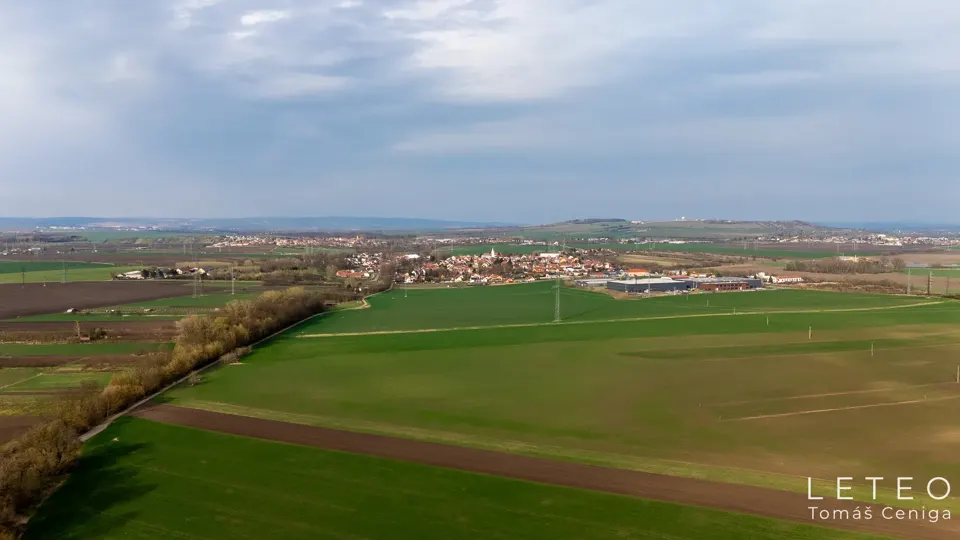
Orthophoto Syrovice near Brno: 4.2 ha, 272 images, 1.9 cm/px.
What is drone photogrammetry
The drone flies pre-planned lines and orbits and captures hundreds of overlapping images. Software finds common points and calculates the spatial shape. The result is a textured 3D model, an orthophoto (a map image without perspective that you can measure on) and a point cloud.
Two ways to work together
A) Data capture to your spec
I calculate and plan the flight for your required detail, fly it and hand over images ready for processing in your software (RealityCapture, Metashape, Pix4D, WebODM).
- geotagged images, flight plan (KMZ)
- short flight summary: altitude, cm/px, overlap, image count
- completeness and quality check of the images
For studios and companies with their own processing.
B) Full processing
On top of the data I deliver finished outputs: 3D model, orthophoto and point cloud in the formats you need. Larger areas are processed in a powerful cloud by arrangement.
- textured OBJ / FBX model
- GeoTIFF orthophoto, LAZ / PLY point cloud
- flight summary, scale check and an interactive model link on request
For clients without their own processing.
What I can handle
| Brief | Detail | Option |
|---|---|---|
| Family house, villa, small building | 1–2 cm/px | A and B |
| Small complex, site up to 2 ha | 1.5–2.5 cm/px | A and B |
| Plot, construction site, area up to tens of hectares | 2–4 cm/px | A, B by arrangement |
Large areas are split into overlapping blocks and flown in even light so the images join without seams. For large areas I recommend a few surveyed control points; without them I state it in the flight summary as a limitation.
What I need for a quote
- area boundary (map link or KML)
- required detail (cm/px) or what the output is for
- outputs and formats, coordinate system (S-JTSK / UTM)
- timing and whether data capture is enough or you need processing too
Deliverables
| Output | Format | Use |
|---|---|---|
| Orthophoto | GeoTIFF (S-JTSK / UTM 33N) | site plan, design base |
| 3D mesh | OBJ / FBX + textures | 3D context for visualizations and CGI |
| Point cloud | LAZ / PLY | terrain heights, comparison over time |
| Camera positions | FBX | camera matching renders into photos |
| Fixed views | JPG / DNG | photomontage of a future building |
| Flight summary | TXT / PDF | date, altitude, detail, image count, limitations |
Who it is for
- Visualization studios - 3D context and camera positions so a new building fits the photo precisely.
- Architects - up-to-date orthophoto and 3D surroundings for studies and presentations.
- Developers - site condition before construction and repeated captures during construction. See video and time-lapse for developers.
Verified results
- Orthophoto, Syrovice near Brno - 4.2 ha, 272 images, 1.9 cm/px, scale deviation 0.2 %.
- 3D model of a house on a slope - 173 images all aligned, 1 cm/px, scale deviation 0.3 %.
What it is not
It is not a land survey. Without RTK, outputs are accurate relatively (shape, proportions, scale), not absolutely in coordinates. Glass, water, shiny surfaces and movement reconstruct poorly.
Photogrammetry FAQ
Can I get just the images and process them myself?
Yes. I plan the flight for your required detail and overlap and hand over geotagged images, the flight plan and a short flight summary. Before delivery I check the images for completeness and quality.
How large an area can you cover?
From a single house to areas of tens of hectares. Large areas are split into overlapping blocks. For large areas I deliver data for processing in your software, or full cloud processing by arrangement.
How accurate is a drone 3D model?
Shape and scale are very accurate: test flights showed scale deviations of 0.2 % and 0.3 % at 1–2 cm per pixel. Absolute position in coordinates is within about 1 m without RTK, so it is not a survey-grade output.
Does it replace a land surveyor?
No. For cadastral, permit or boundary work you need a licensed surveyor. Drone photogrammetry is input for visualization, design, presentation and as-is documentation.
Which files do I get?
Depending on the brief: textured OBJ or FBX model, GeoTIFF orthophoto (S-JTSK or UTM), LAZ/PLY point cloud, camera positions for camera matching and a short flight summary.
Can I view the model in a browser?
Yes. Besides the files I can provide a link to an interactive 3D model or a short turntable video for web and social media.
How much does it cost?
Pricing is custom, based on area, number of flight layers and required outputs. Send me your brief and I will reply with a quote within 24 hours.
What else I do




Tell me about your project.
A few sentences are enough. I usually reply within 2 hours and send a proposal with a price within 24 hours.
 Where I flyBrno, South Moravia and all of Czechia · travel within 20 km includedService area map →

